Memimpin dengan Location Intelligence.
GeoSIS adalah Spatial Decision Support System (SDSS) yang dirancang untuk membantu organisasi lintas industri dalam mengambil keputusan strategis berbasis lokasi secara objektif dan terukur.
Prinsip Utama
Filosofi kami untuk keputusan spasial yang lebih cerdas.
Berorientasi Keputusan
Fokus pada output keputusan, bukan sekadar peta atau data mentah.
Agnostik Metode
Tidak mengunci pengguna pada satu metode analisa tertentu.
Kematangan Progresif
Analisa dilakukan bertahap dari eksplorasi hingga rekomendasi.
Kerangka Kerja
Pendekatan sistematis untuk memecahkan masalah spasial.
Definisi Masalah
Menentukan tujuan keputusan (misal: ekspansi, optimasi, mitigasi risiko).
Generasi Alternatif
Menghasilkan alternatif lokasi atau wilayah.
Seleksi Kriteria
Menentukan parameter penilaian spasial dan non-spasial.
Evaluasi & Skoring
Mengukur dan membandingkan alternatif.
Rekomendasi
Menyajikan hasil dalam bentuk insight dan rekomendasi.
GeoSIS Intelligence
Platform location intelligence berbasis cloud yang menggabungkan berbagai sumber data seperti demografi, POI, infrastruktur, tata ruang, dan risiko bencana. GeoSIS menjadi solusi end-to-end dari pengumpulan data hingga analisis untuk pengambilan keputusan.
Demografi & Ekonomi
Kepadatan penduduk, daya beli, dan indikator sosial-ekonomi.
Point of Interest
Lokasi detail bisnis, fasilitas, dan landmark.
Infrastruktur & Jaringan
Jaringan jalan, utilitas, pusat transportasi, dan konektivitas.
Tata Ruang & Lahan
Perencanaan penggunaan lahan, regulasi zonasi, dan organisasi spasial.
Risiko Bencana & Geologi
Zona bencana alam, bahaya geologi, dan peta penilaian risiko.
Dan Lainnya
Jelajahi katalog lengkap kami
Jutaan Dataset, Kemungkinan Tak Terbatas
Akses perpustakaan besar data terverifikasi kami atau integrasikan data pribadi Anda dengan mudah. GeoSIS berskala sesuai kebutuhan Anda dari pengumpulan sederhana hingga analitik prediktif yang kompleks.
Kapabilitas Platform
Segala yang Anda butuhkan untuk menganalisis data lokasi.
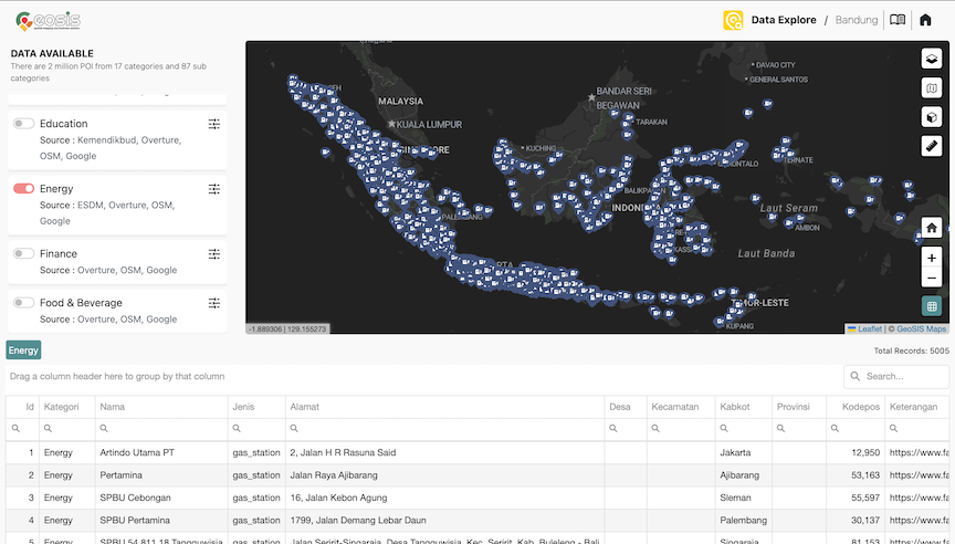
Data Explorer
Eksplorasi data POI secara interaktif melalui peta dinamis dan filter cerdas. Temukan insight lokasi dengan visualisasi yang informatif dan mudah dipahami.
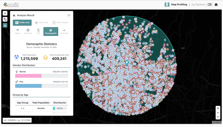
ExploreMap Profiling
Analisis profil wilayah dengan fleksibel dari batas administrasi hingga area kustom. Cocok untuk memahami potensi lokasi secara strategis.
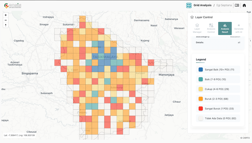
ExploreGrid Analysis
Pecah wilayah menjadi grid untuk analisis detail dan menyeluruh. Ungkap pola tersembunyi dengan pendekatan spasial yang lebih presisi.
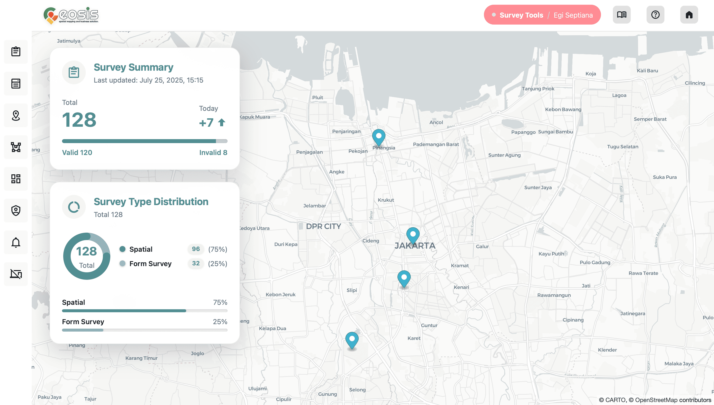
ExploreSurvey Tools
Efisien mengumpulkan data lapangan dalam format polygon, point, atau line. Pilih antara tagging, gambar layar, atau survei berbasis form untuk meningkatkan pengumpulan data lapangan.
Explore


