Lead with Location Intelligence.
GeoSIS is a Spatial Decision Support System (SDSS) designed to help organizations across industries make objective and measurable location-based strategic decisions.
 Pemprov Banten
 Komdigi
 PLN
PLN
 Solusi Bangun Indonesia
 Semen Indonesia Group
 Universitas Pendidikan Indonesia
 Majliz Nusantara
Pemprov Banten
Komdigi
PLN
Solusi Bangun Indonesia
Semen Indonesia Group
Universitas Pendidikan Indonesia
Majliz Nusantara
Majliz Nusantara
Pemprov Banten
Komdigi
PLN
Solusi Bangun Indonesia
Semen Indonesia Group
Universitas Pendidikan Indonesia
Majliz Nusantara
GeoSIS Intelligence Platform
A cloud-based location intelligence platform that combines diverse data sources to empower your decisions. From data collection to advanced analysis, GeoSIS is your end-to-end solution.
One unified platform featuring diverse modules to meet your business analysis requirements
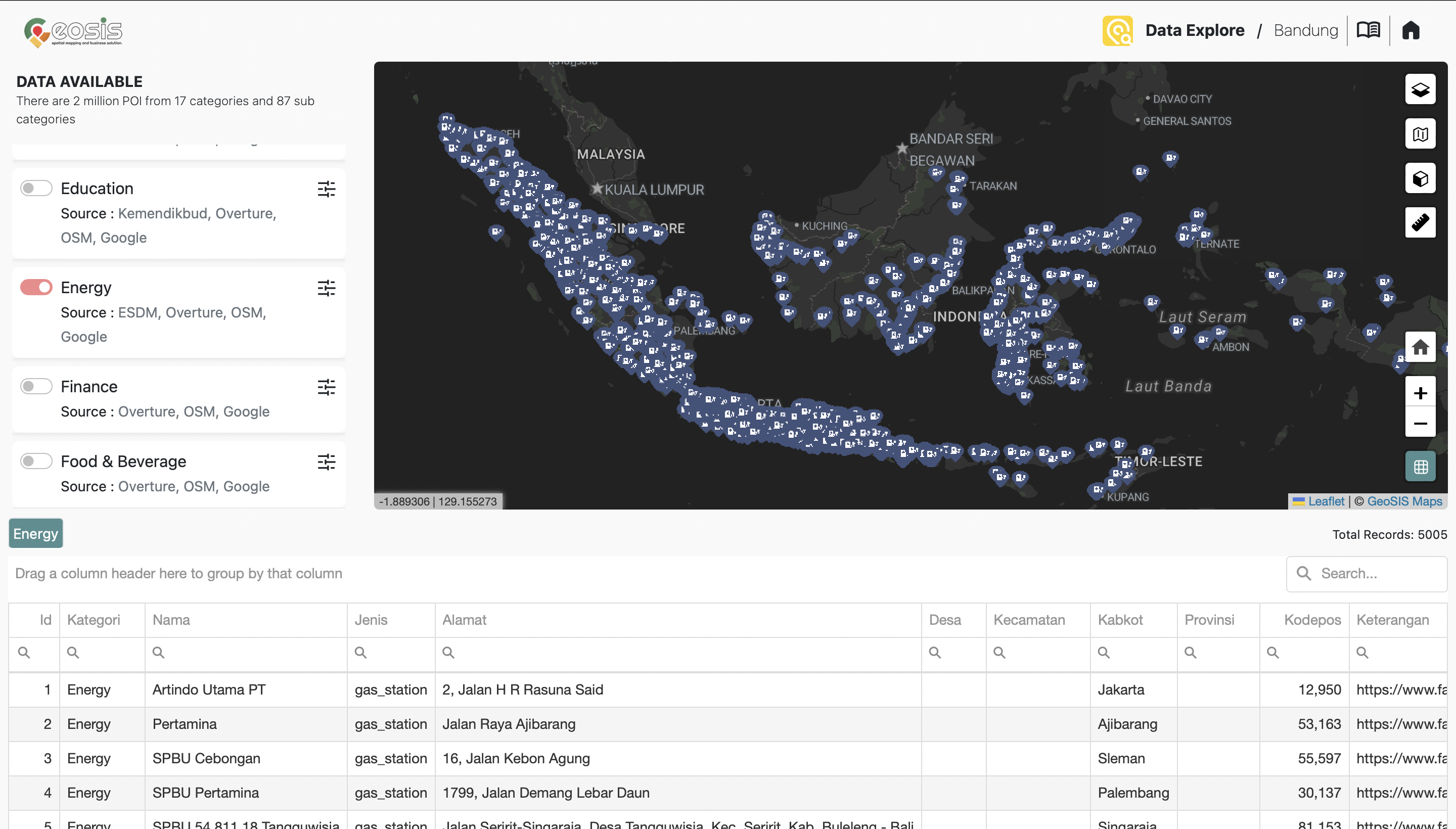
Data Explorer
Explore POI data interactively through dynamic maps, smart filters, and multi-layer visual context. This module helps teams identify location patterns faster and turn raw spatial data into clear, actionable insight.
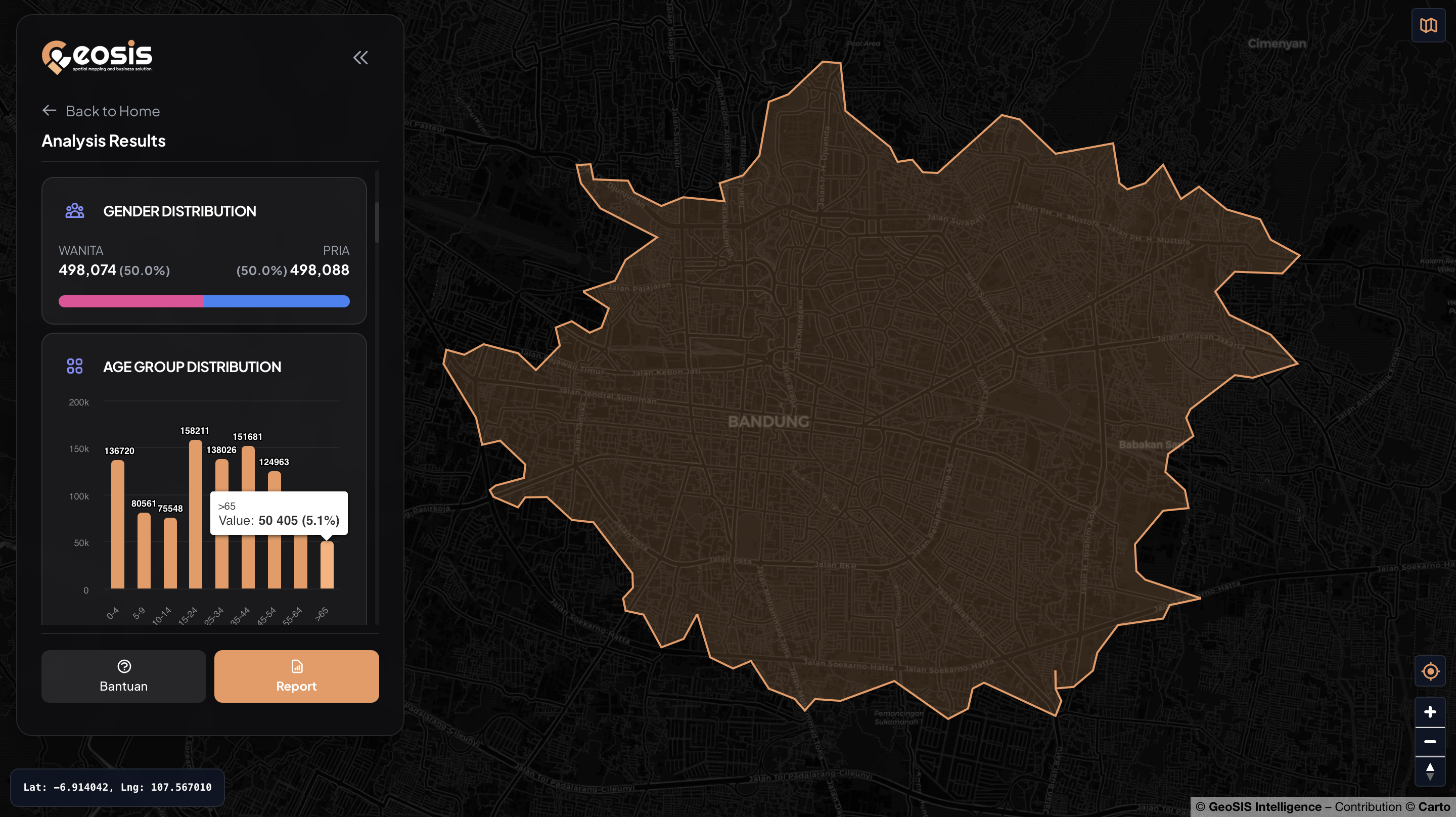
Map Profiling
Analyze area profiles flexibly, from administrative boundaries to fully custom polygons based on your business context. It is designed to help decision makers understand regional characteristics and location potential more strategically.
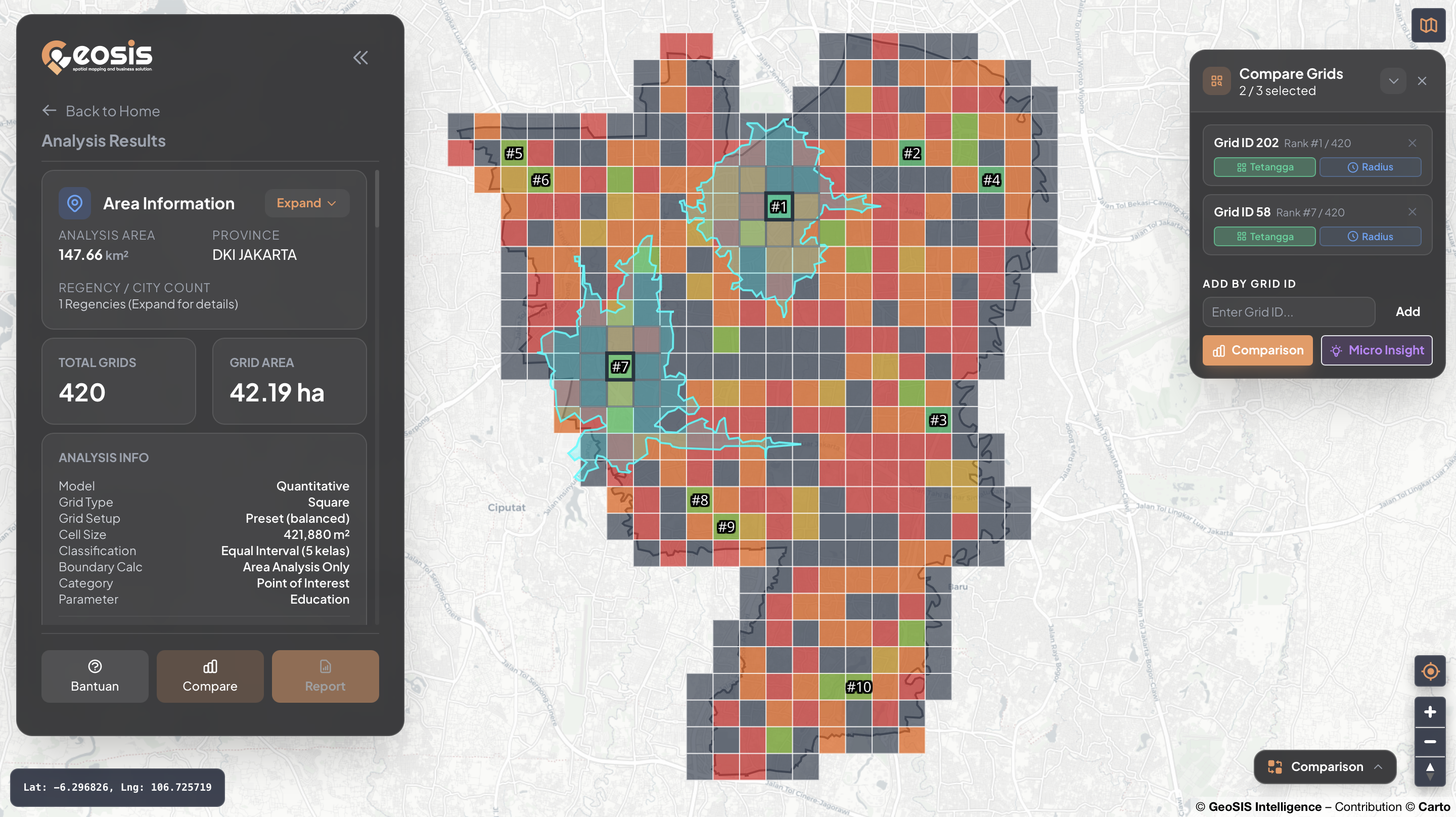
Grid Analysis
Break regions into analytical grids for more detailed, objective, and comparable spatial evaluation. Reveal hidden patterns, score alternatives, and build evidence-based recommendations with higher precision.
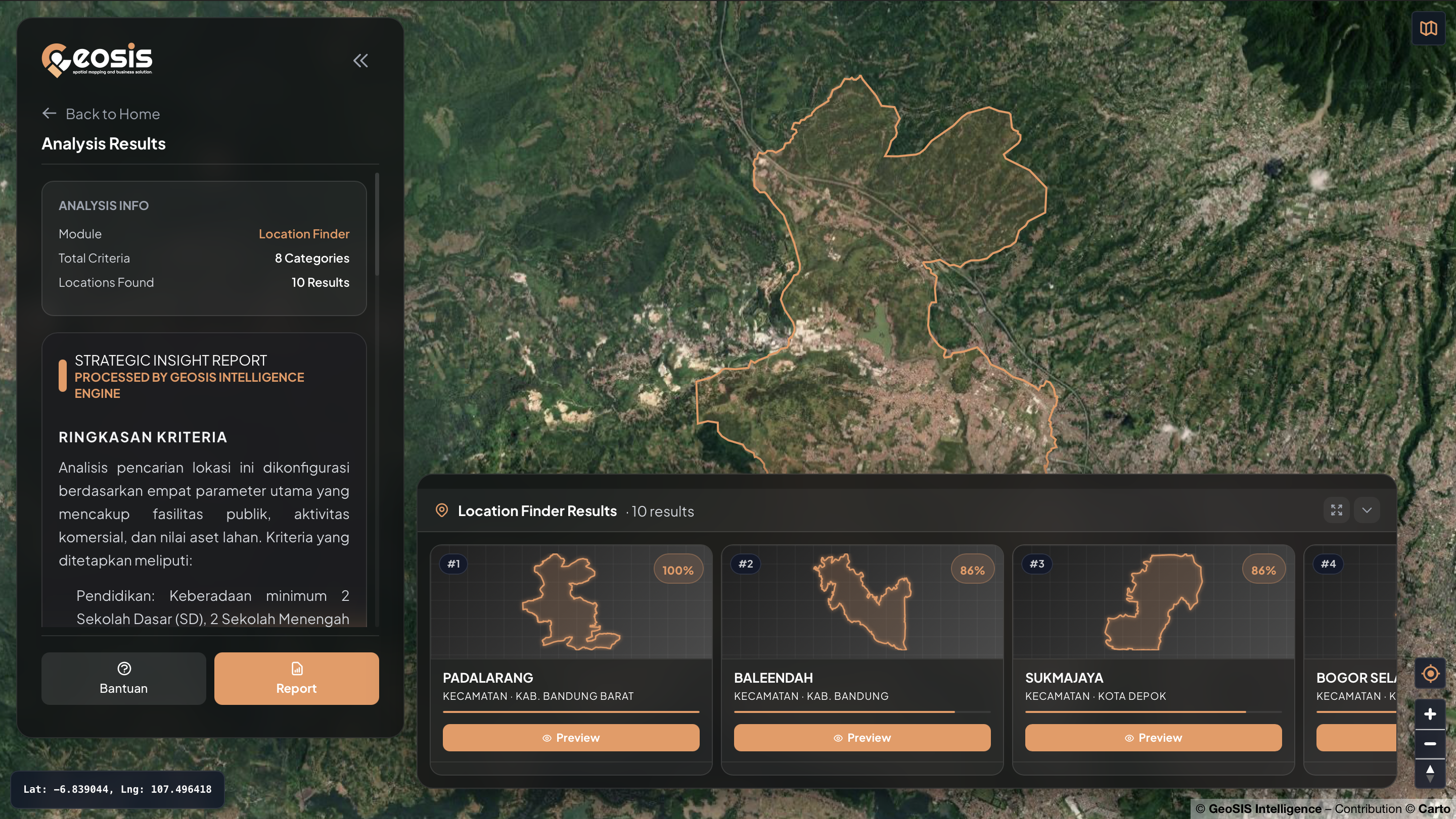
Location Finder
Identify the most suitable administrative areas based on your target criteria. This module helps filter and prioritize candidate areas using relevant business, demographic, accessibility, and other spatial indicators.
GeoSIS Core Advantages
With its powerful suite of modules, GeoSIS helps teams unlock new potential in location data management.
Save Time and Effort
Designed for immediate use without complex implementation, so teams can access insights faster.
Reducing Costs
Comprehensive modules reduce reliance on expensive surveys and repetitive manual collection.
Based on Strong Data
Backed by accurate geospatial data to help leaders identify practical growth opportunities.
Managing Risk
Each module helps assess risk factors such as disaster patterns or regional instability.
Interactive Map
Real-time map visualization makes patterns and trends easier to understand and act on.
Priority Support
GeoSIS experts provide technical and strategic support to maximize output from each module.