Perusahaan
Apa itu GeoSIS?
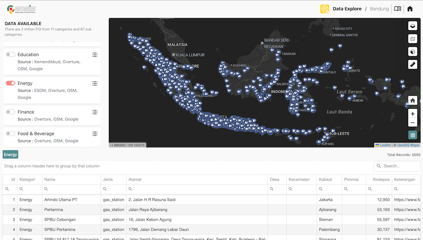
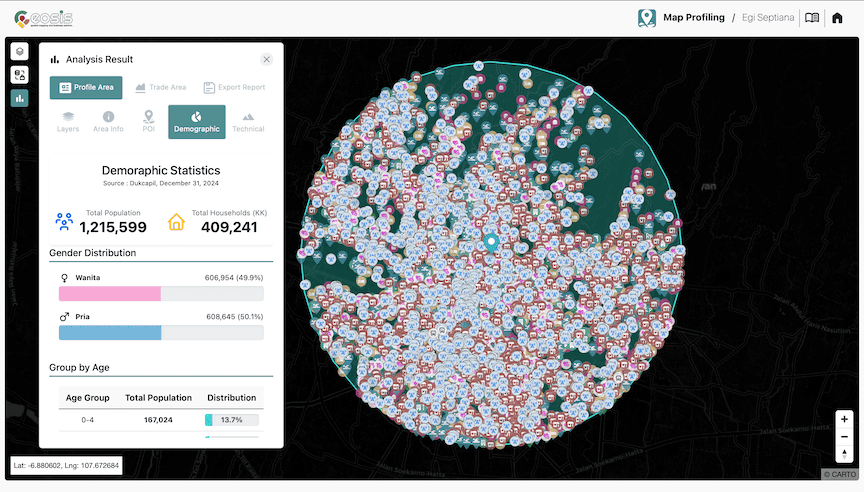
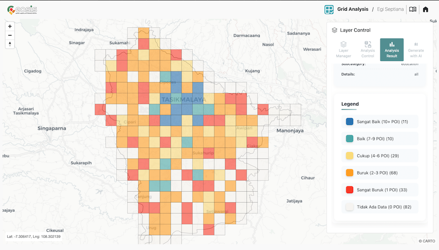
GeoSIS merupakan platform Location Intelligence yang menyediakan berbagai layanan termasuk mendukung kebutuhan dalam memproses, menyimpan, mengelola dan memonitor data Spasial. Dengan menggunakan layanan analisis di GeoSIS, pengguna dapat mengoptimalkan proses bisnis, dan memprediksi hasil di masa depan melalui Spatial Data Science.
Jelajahi Lebih Lanjut